

The only tricky part of this passage was at the beginning. South is to the left on this chart:

The annoying part was how totally wrong the weather forecast was. Lene has become a bit obsessed about checking many sources to get it right and they all said the wind was from the northwest, behind us, but only five to ten knots, so we expected to need the motor, reduced our planning speed, left at 11 am instead of three pm and planned to get to the breakwater of the St. Marys River just after daybreak the next day. But the wind was much stronger, 15 to 20 knots, and from 220 degrees, the very direction we had to go. We played with tacking for a few hours with main and small jib, making great time but not in the right direction, so the remaining distance to the entrance was not diminishing much and the time remaining to get there on these courses would get us there in the late afternoon of the next day. So we furled all sails and motored directly into the wind, with each wave reducing our speed when the bow slammed back into the water after being lifted by the oncoming seas. No heeling, no rolling, just pitching and slamming.


Our choices at the end were threefold: north to an anchorage behind Cumberland Island, west up the St. Marys River or south to Fernandina Beach on the back side of Amelia Island, whose paper plant runs day and night and lights up the area at night for miles.

Well what to do all day? Lene liked the idea of my going ashore and leaving her with the kitties. On our way through the entrance from the sea we passed Fort Clinch on the northern tip of Amelia Island. A good place to explore, but, I was to learn that it was a far piece. A little more than a mile eastward on Atlantic Avenue, which runs the width of Amelia Island to the Atlantic,and then, after entry to the State Park that contains the fort, three more miles north through beautiful woods with nature trails, camp sites, observation points, a fishing pier and bike trails. I hitched a ride after about half a mile, with a man who it turns out is a park employee.
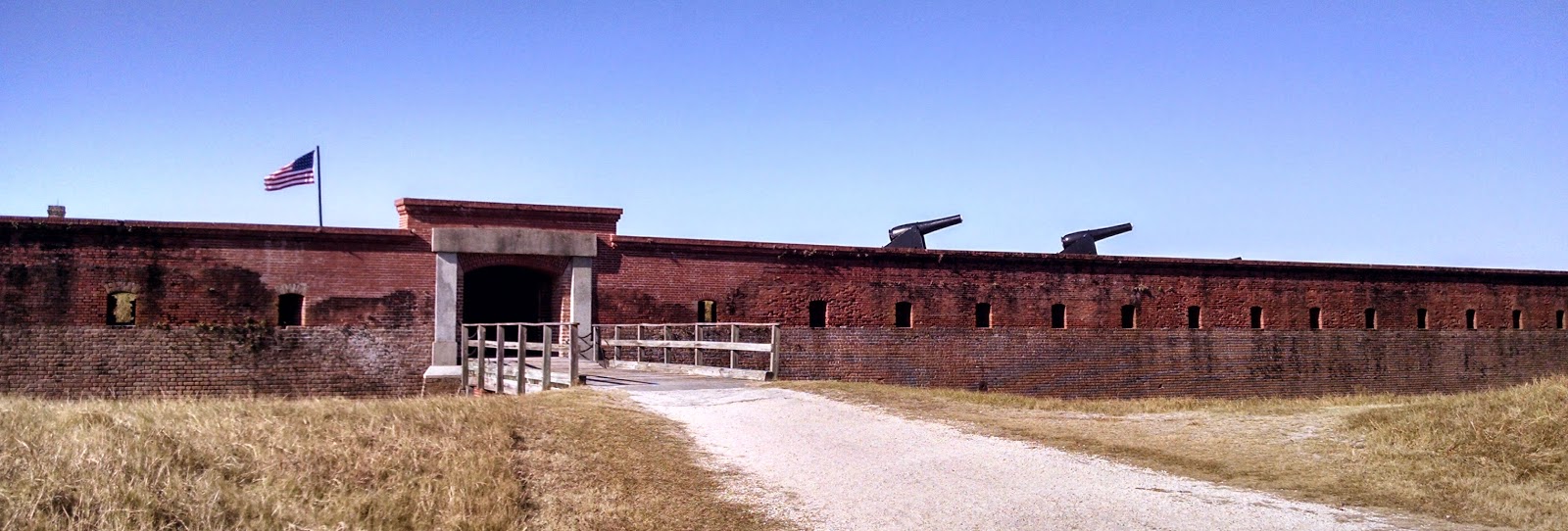

You can see the larger bricks in the lower half of the construction before the Civil war, with the second story added later of smaller bricks.

What made the visit memorable was the performance of Henry Work, a talented artist, in costume as a non-combatant who showed us arms, the infirmary, the storehouse and played the fife. He is a volunteer and has also volunteered to do such a gig at the fort in the Dry Tortugas if the National Park Service accepts his generous offer. I hope they do.

I got to talking with fellow tourists, Norma and Pierre, a retired couple from Montreal who tour the US almost six months each year in their truck drawn trailer. Such nomads are a lot like us, driving land yachts, sharing camaraderie and information with fellow travelers but unlike sailors, they can see the interior of the nation too. They drove me to see their campsite ($25 per night, compared to our mooring at $20) and then back to the marina, where I dinked back to the boat after buying fish, per the Admirals orders.

Aboard were Dean and Susan who had brought a bottle of red. We spent a pleasant few hours together before each couple cooked its own dinner on its own boat.
.


0 komentar:
Posting Komentar